 |
|
1997 Mining History Association Tours The Michigan Copper Country extends from the tip of the Keweenaw Peninsula to Ontonagon and White Pine in the western end of the Upper Peninsula. The greatest concentration of copper deposits and mines were located from just south of Houghton to the eastern end of the Keweenaw. The copper was in the form of pure native copper, found in ancient volcanic rocks formed during the Mid-Continental Rift (1.1 billion years ago). Native Americans had long ago discovered lumps of float copper left behind from the glaciers of the Ice Age. Indian trade goods made of Michigan copper have been found at many locations throughout the Mississippi Watershed. Early explorers and the Cass Expedition, 1820, were aware of the copper deposits. This was the Michigan Territory until Michigan became a state in 1837. The Pittsburgh and Boston Mine was opened in 1844 when the area was still a wilderness. The Army established Fort Wilkins near the current town of Copper Harbor in 1844 to provide protection for the early miners and prospectors. Transportation by water on Lake Superior was the only access to the area. There was no access to the area during the harsh winter weather. Until the opening of the locks at Sault Ste. Marie in 1855, it was necessary to portage incoming supplies and outgoing copper shipments around the rapids of the St. Mary’s River. 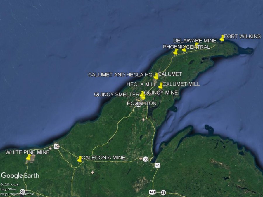 1997 Mining History Association Field Trip Quincy Mine and Smelter Hancock, Michigan June 6, 1997
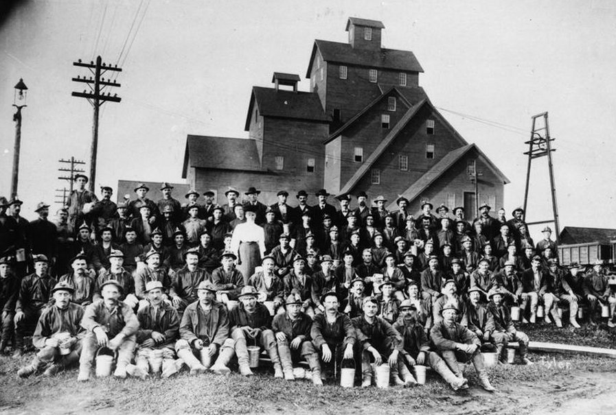
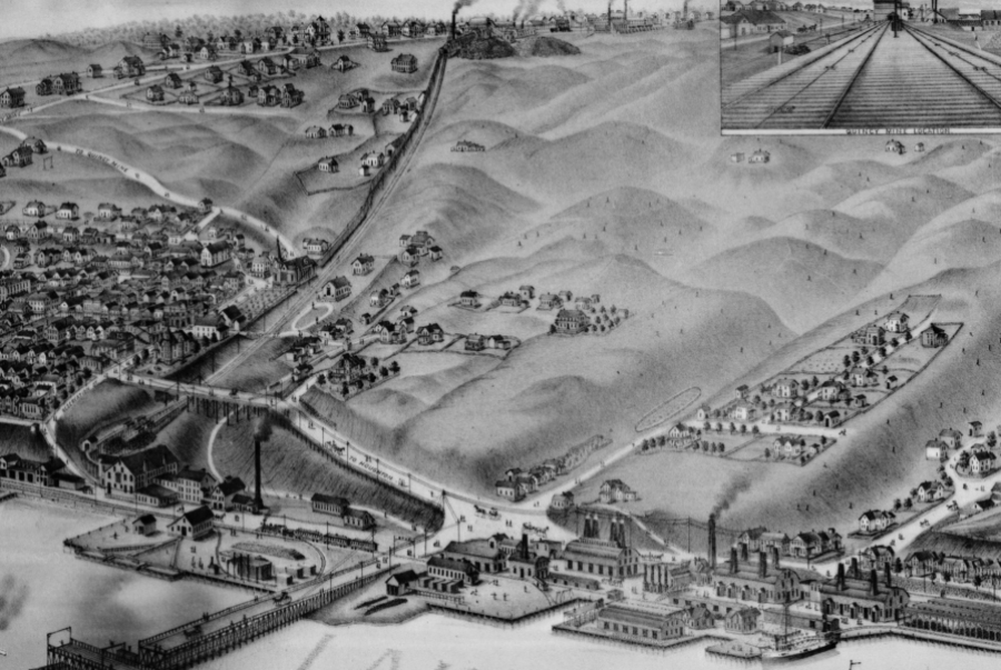
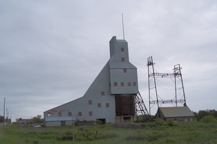
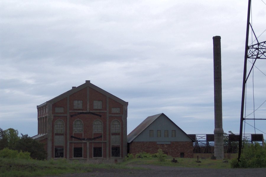
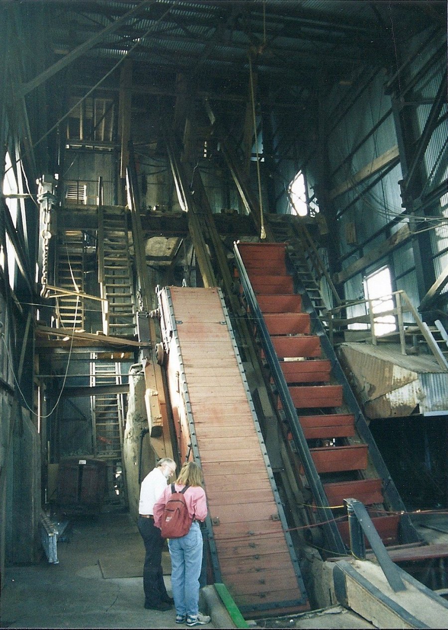
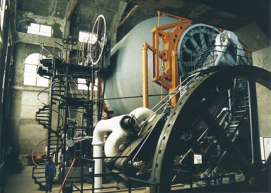
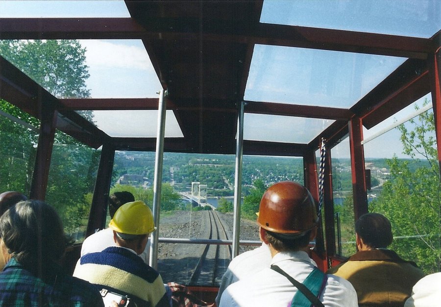
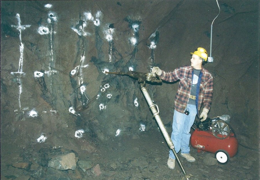
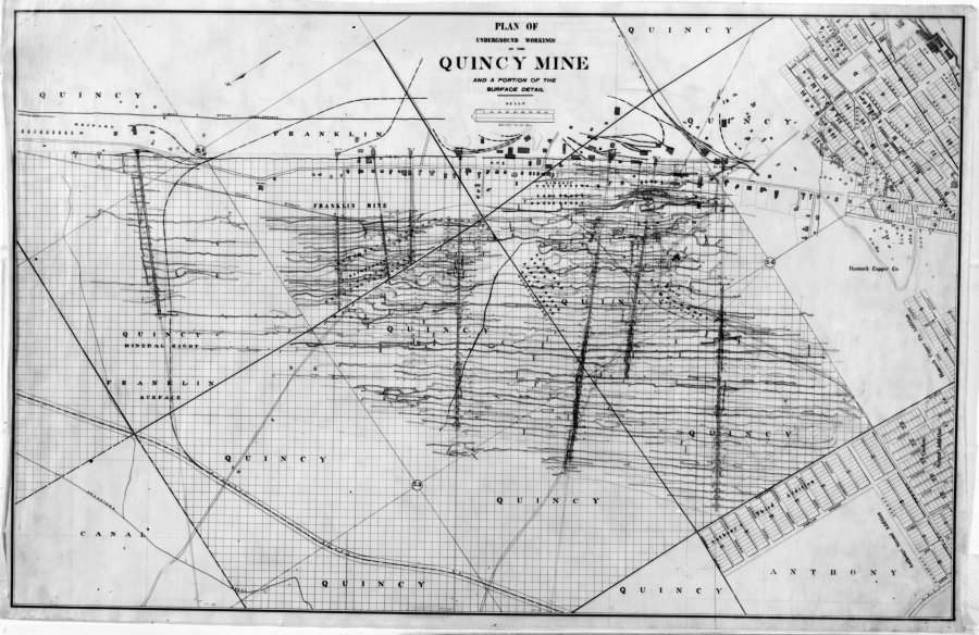
The Quincy Mining Company was formed in 1846 from two predecessor companies, the Portage Mining Company and the Northwestern Mining Company. It was named for Quincy, MA, in recognition of its Boston investors. Its operations were located across the Portage Canal from Houghton in the city of Hancock. The Quincy Mine was located in a hill above the town and followed the copper lode in a northeast-southwest direction. The first shaft began production in 1852. Eventually a series of inclined shafts and rock houses were located along the lode. The Quincy No. 2 shaft, rock house, and hoist house are preserved as part of the Keweenaw National Historical Park and open for tours. The Nordberg mine hoist at the No. 2 was the World’s largest at the time it was installed in 1920. The shaft itself was 9,260 feet deep, the World’s deepest at the time the mine closed in 1945. CLICK HERE for a map of the Quincy Mine workings. CLICK ON A PHOTO TO DISPLAY A LARGER IMAGE
|
Photo Credits: Johnny Johnsson, Mike Kaas and and Library of Congress CLICK HERE TO CONTINUE THE VIRTUAL TOUR |


