Red Mountain Mining District and Silverton, Colorado
June 6, 1999
Host: Duane Smith
PHOTO GALLERY 1
CLICK ON A PHOTO TO DISPLAY A LARGER IMAGE
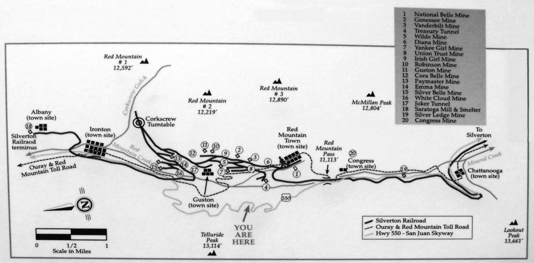
Map of the Red Mountain Mining District from the viewpoint along the Million Dollar Highway, Route 550, between Ouray and Silverton.
(Above) View north toward Ouray from Red Mountain Pass, elevation 11, 018 feet. In 1883 Otto Mears built the first part of the “Million Dollar Highway” from Ouray to Ironton as a toll road to provide access to the mines. It connected to another road from Silverton.
(Left) Red Mountain No. 3 towers above the mining district of the same name at its base. The light dusting of morning snow obscures its normally red color.
Red Mountain No. 2 provides the backdrop for the headframe of the Yankee Girl Mine.
MHAers at the mining district overlook. The trestle once brought ore from the Treasury Tunnel of the Idarado Mine to a mill in the valley below.
By the afternoon return trip, the sun had melted much of the morning snow to reveal the true colors of Red Mountains 1, 2, and 3.
The historic Yankee Girl Mine with its distinctive headframe is representative of the many surviving and restored mining buildings in the district.
The Red Mountain Mining District has undergone extensive environmental restoration.
Aerial view of the Idarado Mine site after environmental restoration (2009 photo)